
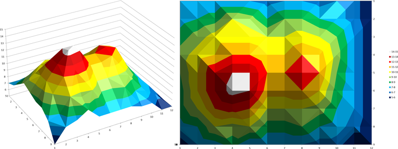
This activity deals with altitude measurements obtained with radar altimetry, a powerful tool used by satellites with low Earth orbits that helps in many different sectors like monitoring of climate changesindicators and disaster management. To simulate the radar operaion, a landscape model hidden inside a box is probed with a rod to obtain the altitude distribution on a regular grid. The data is then represented in three different maps: colour coding, contour map and computer-generated surface map, requiring varying levels of effort for construction.
This activity is part of a larger educational package, the ‘Our Fragile Planet: The Climate Box’ toolkit, and can be linked to the activity ‘The Big Meltdown’.
This activity is part of a larger educational package, the ‘Our Fragile Planet: The Climate Box’ toolkit, and can be linked to the activity ‘The Big Meltdown’.
Resource Link
Activity Information
Big Ideas
Source: AstroEdu – International Astronomical Union